Archive for the 'Chihuahuan Desert' Category
Tuesday, September 4th, 2012
La Cueva – Hermit’s Cave
La Cueva (“the cave”) is the name of a rock formation in the foothills of the Organ Mountains in the Dripping Springs Natural Area. You can see it here:

At the center of the photo, where you see the two trees, is the cave that gives the formation its name. You can see the entrance here:

Once you enter the cave, you see:

The cave has been used as a shelter by humans for at least 5,000 years. You can easily see the blackened ceiling caused by innumerable fires:

Also inside the cave a Parks Service plaque giving information on the most famous occupant of the cave, the Hermit de Agostini. Like almost all the information published about the Hermit, this plaque is full of incorrect facts.

His birth name was Giovanni Maria de Agostini and he was born in 1801 at Sizzano, Piedmont, Italy (not Lombardy as other sources say). After he began his travels and on his passport, he called himself Juan Maria d’Augustine. Physically, he was short, had brown eyes and a long face.
He come from a fairly well-off family and received a formal education, learning Latin, French, and studying theology.
In his early-twenties he began his life as a wanderer, visiting religious sites in Italy, France, and Spain. In 1838 he took the rule of Saint Anthony the Abbot – a decision to lead a Monastic life of poverty and the most austere practices of virtue. Shortly thereafter, he departed Europe for the New World, arriving by boat at Caracas, Venezuela. He was 38 years old.
In South and Central America he traveled in Venezuela, Peru, Brazil, Argentina, Chile, Bolivia, Panama, Guatemala, and Mexico.
In 1861 he left Mexico for Cuba, then New York City. He walked from New York City to Montreal, Canada. From Canada he went to St. Louis, Missouri, then Westport, Missouri, then Council Grove, Kansas. Except when he took boats, he always traveled by foot.
The story on the Parks Service plaque is more or less correct about how he got to Mesilla, after spending several years in Las Vegas, New Mexico.
The reason for his murder is unclear. The motive was clearly not robbery because his large silver cross, silver rosary, and several other items of silver jewelry were not taken. A local priest was indicted for his murder but never tried.
Related posts:
New Book on the Hermit of La Cueva
Hiking Dripping Springs – Part 1
Hiking Dripping Springs – Part 2
Hiking Dripping Springs – Part 3
Dripping Springs – Green, Green, Green!
Tags: Las Cruces, Organ Mountains, Hiking, History, Dripping Springs, Chihuahuan Desert
Tuesday, January 20th, 2009
Hiking Dripping Springs – Part 3
Details on hiking to the springs in Dripping Springs Canyon are given here.
Details on the Van Patten Mining Camp are given here.
Boyd’s Sanitarium
Dr. Nathan E. Boyd came to Las Cruces some time before 1890. Although a medical doctor, he spent almost all his time on real estate and financial speculation. In 1892-3 he began promoting a dam across the Rio Grande River just west of Engle. In 1895 he obtained a permit from the US Government to build the dam.
Construction on the dam began, financed by English capital. However, he immediately ran into huge political opposition. Mexico lodged a formal protest, claiming that it would interfere with her water rights. Agricultural interests in the Mesilla Valley strongly turned against the plan when it became clear what Boyd intended to charge. The proposed fee was one half of any land irrigated by water from the dam. Other opponents used the issue of the Rio Grande River being a navigable body of water to tie up the project in the courts.
The battle lasted until 1903, when the project was finally defeated. But Boyd continued to be legally entangled in the fallout for another decade.
Nine years later, in 1912, construction began on the Elephant Butte Dam, which was located south of Boyd’s dam site. This project was only possible because of the battles Boyd fought. He lost those fights, but started the processes that led to their eventual settlement.
In 1905 Boyd founded the First National Bank of Las Cruces. A year later he was forced out of the company due to loans to himself. He then organized the Mesilla Valley Real Estate Company, which among other ventures, purchased and re-sold the old Shalam Colony site.
So, by the time that Boyd bought the Dripping Springs property in 1917, he was known for his grandiose ideas. He immediately announced a huge sanitarium would be built on the site. In the end, he build only a small sanitarium.
The ruins of the Boyd Sanitarium are south of the springs, up a short path:

Here’s the dining area of the sanitarium, half of it built on stilts:


Here’s what the inside looks like, taken through the door. Entrance into the structure is forbidden, due to its fragile condition.

Here you can see what a gorgeous setting it is:

To one side and below the sanitarium is the operator’s house, or Boyd’s house, depending upon the account:

A close up of the house:

Again, entrance is forbidden.
Some time in the 1920s Dr. Boyd sold the property to Dr. T. C. Sexton and moved to Washington D. C. Does anyone know what happened to him after he left Las Cruces?
Related posts:
La Cueva – Hermit’s Cave
Hiking Dripping Springs – Part 1
Hiking Dripping Springs – Part 2
Dripping Springs – Green, Green, Green!
Tags: Las Cruces, Organ Mountains, Hiking, History, Dripping Springs, Chihuahuan Desert, Nathan E. Boyd
Tuesday, November 4th, 2008
Hiking Dripping Springs – Part 2
Details on hiking to the springs in Dripping Springs Canyon are given here.
Details on the Boyd Sanitarium are given here.
Van Patten Mining Camp
The ruins of the Van Patten Mining Camp are a short hike north of the springs. Construction of the Camp began about 1895 and was completed and advertising for business in 1897. The Camp sold itself as a vacation resort in the Organ mountains several thousand feet above the sultry southern New Mexico desert. The resort building was L-shaped. One two-story wing had 14 hotel rooms for customers, and the other wing a large dining hall, a dance hall, a roller skate rink, and living rooms for the operators.
A historical marker at the site provides a photo of what the Camp, also known as the Dripping Springs Resort, looked like in 1900.

The marker provides a few historical details on Van Patten, but does not convey the extent of the accomplishments of this remarkable New Mexico pioneer.
Albert Eugene Van Patten was born November 10, 1839 in Oneida, New York, but many sources give a different, erroneous birth date.
In 1857 when John Butterfield was starting the Overland Mail Company, he hired Van Patten and his three older brothers to help set up the El Paso link of the stagecoach trail. They arrived in El Paso as part of the first Overland work crew on December 23, 1857. Van Patten did all kinds of work for the Company, including driving stages and serving as stationkeeper at the Picacho Station.
On February 9, 1860, Van Patten was the conductor of a stage coach ambushed by Apaches in Cooke’s Canyon on its way from Tucson to Mesilla. After a long standoff in which all of coach’s mules but one were killed, Van Patten, the driver, and the six passengers abandoned the coach and fortified themselves behind rock outcrops. They were rescued eventually by scouts of a merchant party which happened to hear shooting.
When the civil war started he joined the Confederates, even though he was born a Yankee. Following the war, he was a life-long Republican.
In 1865 he married Benita Madrid Vargas, a high ranking Piro Indian. This began a life-long commitment to Indian interests, and he was a major player in the Piros relocating to Tortugas and being granted title to that land by the State of New Mexico in 1914.
He served in many offices, including county sheriff from 1884 to 1888 and deputy U. S. Marshall from 1889 to 1896. He led the posse that tracked the murders of Colonel Albert Fountain and his son Henry, and was a major witness at the trial (the accused were acquitted). Although unable to serve, he helped organize the New Mexico contingent of Roosevelt’s Rough Riders.
In 1917 (not 1915 as given by the historical marker) he sold the Van Patten Mountain Camp to Dr. Nathan Boyd and entered a long period of financial difficulties. When he died on February 28, 1926, he was almost destitute.
The Ruins
The Camp Ruins are extensive, and make stunning photographs. This part of the original structure is in the best condition. Note how the two end windows in the eve match the windows in the old photo.


These ruins are of the other wing.


Picnic Area
Take your lunch, because there is a lovely, shaded picnic space next to the Camp ruins.

Related posts:
La Cueva – Hermit’s Cave
Hiking Dripping Springs – Part 1
Hiking Dripping Springs – Part 3
Dripping Springs – Green, Green, Green!
Sources:
Las Cruces New Mexico, 1849-1999, Gordon Owen, Red Sky Publishing Company, Inc, 1999.
Pioneers of the Mesilla Valley, Paxton P. Price, Yucca Tree Press, 1995
The Butterfield Trail in New Mexico, George Hackler, Yucca Enterprises, 2005
Tags: Las Cruces, Organ Mountains, Hiking, History, Dripping Springs, Chihuahuan Desert, Eugene Van Patten
Wednesday, October 15th, 2008
Hiking Dripping Springs – Part 1
The hike from the Dripping Springs Visitors Center to the springs is about 1-1/2 miles. The hike is considered easy, although it does climb about 1500 feet. It is definitely a good idea to take water.
The Hike
Here’s what the path looks like about five minutes from the departure point:

If you look back, you can see the La Cueva rock formation:

About 1 mile still to go. On your return to this point, you can choose to go directly back to the Visitors Center, or to take one of several longer routes:

There are several places along the trail where you can rest and contemplate the wonderful views. Here’s one under an Alligator Juniper:

This is what you are heading for:

The Livery
Before you reach the springs, you come across the re-located Eugene Van Patten livery buildings:

A historical marker at the site provides the following information about the buildings:
“The wooden structures in this area were constructed in the late 1800’s by Major Eugene Van Patten. These buildings were associated with Van Patten’s Mountain Camp, a historic resort hotel located approximately 1/4 mile further up the canyon. These out buildings served as a livery, mercantile, and chicken coop for the hotel. Wagons were kept under a long barn which has collapsed. The barn was adjacent to the corral.”
“In the late 1800’s a stageline brought guests to the hotel from Las Cruces, a 17 mile trip. The stage would deliver the guests to the front of the hotel and then return to the livery. The wagons and horses for the stagelines, as well as the personal livestock of the guests were kept in this area. A milk cow and garden were also maintained in this area. Fresh vegetables (when available), beef, milk, and eggs were served to the guests at the hotel dining room.”

“The photograph shows a number of guests preparing to leave from the hotel by buggy for a trip to Dona Ana in April of 1897. Local Indian boys worked at the livery, the hotel, and on the road maintenance crew. In the early 1900’s guests began to arrive at the hotel in automobiles as well as horse and wagon. The hotel ceased operations in the 1920’s.”
“The BLM is stabilizing and partially restoring portions of these ruins. Please do not touch or enter the unstabilized ruins as they are extremely fragile.”
The Springs
Approaching the springs:

Getting closer:


And closer:

As you can see, on this date (9/23/08), there was very little water coming from the springs:

Here you can see the rock cistern that was built below the springs to capture water. The cistern is completely filled in today:

Related posts:
La Cueva – Hermit’s Cave
Part 2 – Van Patten’s Mountain Camp
Part 3 – Boyd’s Sanatorium
Dripping Springs – Green, Green, Green!
Tags: Las Cruces, Dripping Springs, Organ Mountains, Hiking, Chihuahuan Desert
Saturday, September 20th, 2008
Dripping Springs – Green, Green, Green!
Old timers are saying they’ve never seen the Chihuahuan Desert around Las Cruces as green as it is this year.
Here are a few pictures taken at Dripping Springs last weekend. In spite of the cloud cover at that moment, you can see how green it is.

The rock formation in the foreground in this photo is known as La Cueva, because of the cave at its base. More on this famous cave in a later posting.

A different view of La Cueva.

The cave is located about the middle of the rock formation, at ground level, where you see several trees. There are three small springs nearby that are difficult to locate, particularly when it’s dry.

These were taken as the sun set.


To visit Dripping Springs, take University Avenue/Dripping Springs Road east toward the Organ Mountains. Stay on the road until its end, even after it becomes a dirt road. The last quarter mile before you get to the park is paved.
The park closes at 5 pm. There is a fee for hiking to La Cueva and the other areas of the park, but not for seeing the Visitor’s Center or the always SPECTACULAR VIEWS.
Related Posts:
Hiking Dripping Springs – Part 1
Hiking Dripping Springs – Part 2
Hiking Dripping Springs – Part 3
Tags: Las Cruces, Dripping Springs, Hiking, Windmill, Chihuahuan Desert
Wednesday, September 10th, 2008
Soledad Canyon – Green, Green, Green!
After a very dry winter, spring, and summer, we have been getting some FINE rains. As a result, the desert around Las Cruces is greener than I can remember it ever being. It’s not just the amount of rain, probably, but it’s also the timing.
Here are some photos today taken at the base of Soledad Canyon, in the Organ Mountains.


Soledad Canyon is a public park and a wonderful place to hike. It’s about a 12 minute drive from NMSU.
To visit Soledad Canyon, take University Avenue/Dripping Springs Road east for about 4.5 miles, then turn south on the Soledad Canyon Road. That road will turn east toward the mountains in a mile; follow it all the way to the end. For the last fifth of a mile the road is unpaved; it ends at the park’s parking area.
If hiking in the park, be sure and register at the map box at the foot of the trail. You can bring your dog[s]. The park permits day use only.
Tags: Las Cruces, Soledad Canyon, Windmill, Chihuahuan Desert
Saturday, October 21st, 2006
The Trashers
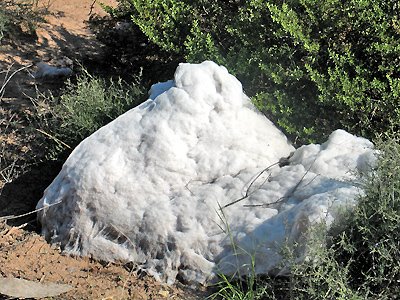
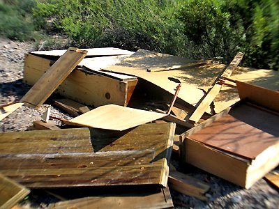
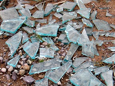
Everywhere in the desert around Las Cruces you see the offal of The Trashers. Not just a few cans, papers, bottles, but pickup loads.


Tags: Trashers
Wednesday, September 13th, 2006
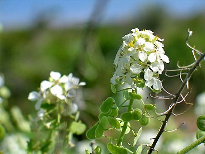
Desert Flowers
The extensive recent rains have lead to a greening and flowering in the desert around Las Cruces that is rare in recent times. Here are a few photos taken yesterday.

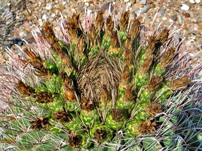
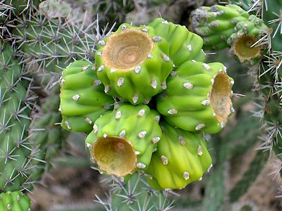
A 3-foot barrel cactus:

The flowers always grow at the top of the plant.
Tags: Desert Flowers, Chihuahuan Desert